The Peak District Trig Baggers Logbook
Trig points, or trigonometrical stations to give them their proper name, are a common sight and much-loved feature of Britain’s hills. Constructed between 1936-1962 as part of the Ordnance Survey’s retriangulation of Great Britain, this logbook is your ideal hiking companion as you bag them all in the Peak District National Park.
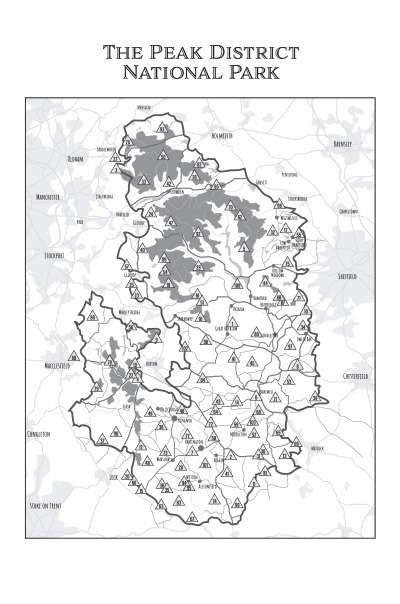
This logbook contains over 100 trig points to be found in the Peak District – as well as a couple that sit just outside of the national park boundary. All the popular mountain tops are featured, as well as some of the lesser known in quaint villages and church spires are also included.
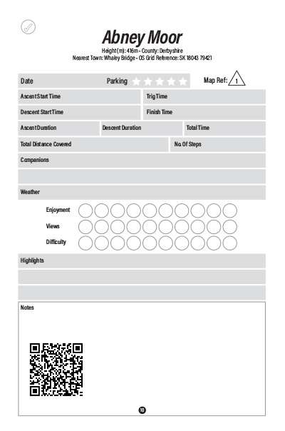
All the trig points in this book are easy to find – listed on comprehensive contents pages ordered by height ascending, alphabetical order and by county so you can easily find your next target trig! What’s more, each trig point page has it’s OS Grid reference included as well as a QR code you can scan to open a map of the trig point on your phone and plan your trek.
Perfect for logging all your adventures to look back on for years to come.
Log book pages include:
- Trig point information includes; Trig name, height, county, nearest town & OS grid reference.
Then record your trek by filling in the details:
- Date
- Parking
- Ascent & descent times
- Distance
- Steps
- Companions
- Weather
- Enjoyment, views & difficulty
- Space for notes or images
Key Features
- Easy to use contents pages
- 103 Trig points
- Covers The Peak District National Park & Surrounding Areas
- Trig-per page layout
- Includes QR codes to open maps on your smartphone
- Perfect for walkers & hikers
Sample pages from this book:


